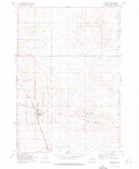
1973 Map of Wolsey
USGS Topo · Published 1976About this map
The railroad junction at Wolsey serves as the focal point of this Beadle County landscape in the early 1970s. The town is defined by the intersection of the Chicago and North Western and the Chicago Milwaukee St Paul and Pacific railroads, a configuration that historically anchored the region's agricultural shipping. The surrounding prairie is divided into the townships of Allen, Broadland, and Hartland, where small-scale local landmarks like the Townhall in the northwest corner and the St Johns Cem to the southwest offer specific points of interest for genealogists.
Find a feature on this map
16 named features on this map. Tap any name to fly to it.
Don’t see what you’re looking for? This feature index may not catch every label — zoom into the map to look around manually.
Map Details
Editions of this 1973 Wolsey Map
This is the sole edition of this map. No revisions or reprints were ever made.
Other maps of this area

1895 · Byron
USGS Topo · 1:125,000

1898 · Huron
USGS Topo · 1:125,000

1899 · Redfield
USGS Topo · 1:125,000

1950 · Wessington NE
USGS Topo · 1:24,000

1951 · Wessington SE
USGS Topo · 1:24,000

1953 · Huron
USGS Topo · 1:250,000

1954 · Huron
USGS Topo · 1:250,000

1956 · Hitchcock SE
USGS Topo · 1:24,000

1967 · Hitchcock SW
USGS Topo · 1:24,000

1967 · Tulare SE
USGS Topo · 1:24,000