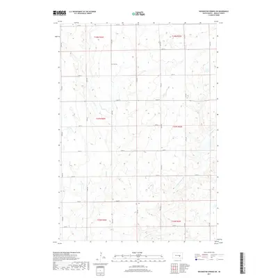
2017 Map of Wessington Springs SW
USGS Topo · Published 2017About this map
Smith Creek and its tributary, E Fork Smith Creek, drain this rural portion of Jerauld County, shaping a landscape of numerous small wetlands and prairie potholes. The map reveals the rigid section lines of the Public Land Survey System, which dictate the placement of a dense grid of local roads like 374th Ave and 228th St. In the northern part of the quadrangle, Hope Cem serves as a significant landmark for genealogical research, representing the spiritual and social center for the surrounding farmsteads. The terrain is characterized by subtle elevation changes that influence the seasonal flow of the creeks as they wind through sections of Township 107 North, Range 66 West and neighboring townships.
Find a feature on this map
25 named features on this map. Tap any name to fly to it.
Don’t see what you’re looking for? This feature index may not catch every label — zoom into the map to look around manually.
Map Details
Editions of this 2017 Wessington Springs SW Map
This is the sole edition of this map. No revisions or reprints were ever made.
Other maps of this area

1941 · Kimball North
USGS Topo · 1:62,500

1942 · Crow Lake
USGS Topo · 1:62,500

1951 · Kimball North
USGS Topo · 1:62,500

1953 · Huron
USGS Topo · 1:250,000

1954 · Huron
USGS Topo · 1:250,000

1955 · Mitchell
USGS Topo · 1:250,000

1959 · Mitchell
USGS Topo · 1:250,000

1973 · Wessington Springs NE
USGS Topo · 1:24,000

1973 · Cottonwood Lake
USGS Topo · 1:24,000

1973 · Wessington Springs
USGS Topo · 1:24,000