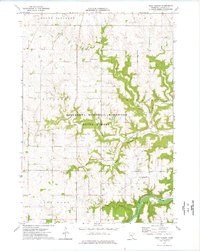
1974 Map of West Albany
USGS Topo · Published 1976About this map
Minnesota Memorial Hardwood State Forest dominates the central landscape of this Wabasha County region, where the wooded drainages of Hungry Hollow and Hell Coulee break the upland plateaus. The topography is defined by sharp elevation changes between ridges like Rish Ridge and the winding course of the Zumbro River in the southeast. This 1974 survey captures the rural character of the area, centered on the settlement of West Albany, which sits at the junction of several valley roads.
Find a feature on this map
20 named features on this map. Tap any name to fly to it.
Don’t see what you’re looking for? This feature index may not catch every label — zoom into the map to look around manually.
Map Details
Editions of this 1974 West Albany Map
This is the sole edition of this map. No revisions or reprints were ever made.
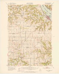
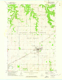
Other maps of this area

1932 · Wabasha
USGS Topo · 1:62,500

1934 · Plainview
USGS Topo · 1:62,500

1935 · Rochester
USGS Topo · 1:48,000

1938 · Plainview
USGS Topo · 1:62,500

1939 · Rochester
USGS Topo · 1:62,500

1951 · Wabasha
USGS Topo · 1:62,500
1951 · Lake City
USGS Topo · 1:62,500

1953 · Saint Paul
USGS Topo · 1:250,000

1959 · Saint Paul
USGS Topo · 1:250,000
1972 · Plainview
USGS Topo · 1:24,000