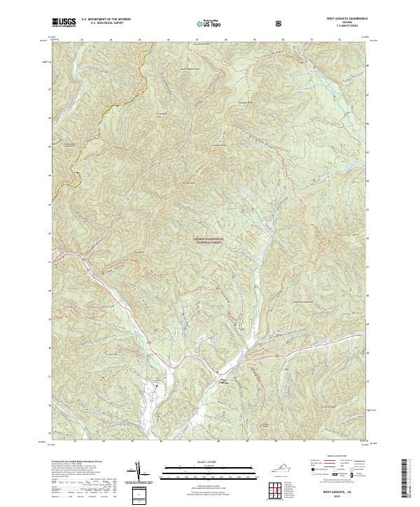
2022 Map of West Augusta
USGS Topo · Published 2022About this map
West Augusta sits at the junction of mountain roads and winding waterways, serving as a primary point of human settlement within the expansive George Washington National Forest. The landscape is dominated by the steep ridges of Shenandoah Mountain and Hankey Mtn, where numerous drafts and runs converge into the Calfpasture River. This area is characterized by a high density of named geographic points that indicate a long history of local woodsmanship and land use, from the heights of Hardscrabble Knob to the quiet waters of Braley Pond.
Find a feature on this map
93 named features on this map. Tap any name to fly to it.
Don’t see what you’re looking for? This feature index may not catch every label — zoom into the map to look around manually.
Map Details
Editions of this 2022 West Augusta Map
This is the sole edition of this map. No revisions or reprints were ever made.
Other maps of this area

1894 · Staunton
USGS Topo · 1:125,000

1924 · Mc Dowell
USGS Topo · 1:62,500

1943 · Craigsville
USGS Topo · 1:62,500

1944 · Parnassus
USGS Topo · 1:62,500

1944 · Mc Dowell
USGS Topo · 1:62,500

1944 · Staunton
USGS Topo · 1:62,500

1945 · Craigsville
USGS Topo · 1:62,500

1946 · Mc Dowell
USGS Topo · 1:62,500

1947 · Staunton
USGS Topo · 1:62,500

1947 · Parnassus
USGS Topo · 1:62,500