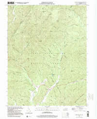
1999 Map of West Augusta
USGS Topo · Published 2000About this map
West Augusta sits at the base of the dramatic ridgelines that define the border between Highland and Augusta counties. This late-twentieth-century landscape is dominated by the George Washington National Forest, where high elevations like Hardscrabble Knob and The Pinnacle overlook a complex network of drafts and hollows. The settlement pattern is concentrated along the Calpasture River, with the West Augusta Cem serving as a local genealogical landmark. To the north, the terrain rises toward Shenandoah Mountain, where recreational sites like Braley Pond and Camp Todd are tucked away near the headwaters of the North River. The map meticulously records the numerous natural springs, such as Hiner Spring and Sulphur Spring, which have long been vital to the hydrology and early settlement of this mountain corridor.
Find a feature on this map
84 named features on this map. Tap any name to fly to it.
Don’t see what you’re looking for? This feature index may not catch every label — zoom into the map to look around manually.
Map Details
Editions of this 1999 West Augusta Map
This is the sole edition of this map. No revisions or reprints were ever made.
Other maps of this area

1894 · Staunton
USGS Topo · 1:125,000

1924 · Mc Dowell
USGS Topo · 1:62,500

1943 · Craigsville
USGS Topo · 1:62,500

1944 · Parnassus
USGS Topo · 1:62,500

1944 · Mc Dowell
USGS Topo · 1:62,500

1944 · Staunton
USGS Topo · 1:62,500

1945 · Craigsville
USGS Topo · 1:62,500

1946 · Mc Dowell
USGS Topo · 1:62,500

1947 · Staunton
USGS Topo · 1:62,500

1947 · Parnassus
USGS Topo · 1:62,500