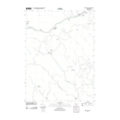
2010 Map of West Creek
USGS Topo · Published 2010About this map
West Creek and the small settlement of Truman anchor the northern landscape of this Elk County region, where the winding waterway of West Creek carves a path through the Pennsylvania highlands. The era of railroad infrastructure is evidenced by the Howard Siding, while the surrounding terrain is defined by a complex network of hollows and runs, including Horning Hollow, Bruner Hollow, and Hercules Hollow.
Find a feature on this map
46 named features on this map. Tap any name to fly to it.
Don’t see what you’re looking for? This feature index may not catch every label — zoom into the map to look around manually.
Map Details
Editions of this 2010 West Creek Map
This is the sole edition of this map. No revisions or reprints were ever made.
Other maps of this area

1941 · Benezette
USGS Topo · 1:62,500

1943 · Benezette
USGS Topo · 1:62,500

1945 · Driftwood
USGS Topo · 1:48,000

1945 · Driftwood
USGS Topo · 1:24,000

1945 · Cameron
USGS Topo · 1:24,000

1947 · Cameron
USGS Topo · 1:24,000
1947 · Driftwood
USGS Topo · 1:24,000

1948 · Crosby
USGS Topo · 1:62,500

1948 · Emporium
USGS Topo · 1:62,500

1948 · Emporium
USGS Topo · 1:24,000
Featured Places
- Benezette Township, PA
- Gibson Township, PA
- Lumber Township, PA
- Shippen Township, PA
- Truman, Shippen Township