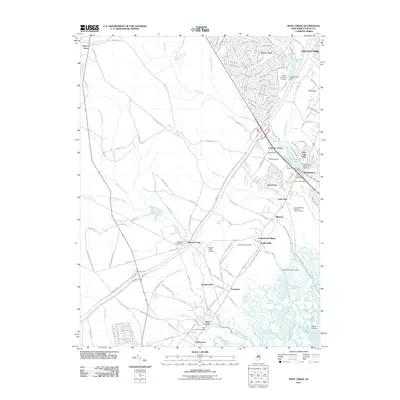
2011 Map of West Creek
USGS Topo · Published 2011About this map
Manahawkin serves as the primary hub for this coastal region of New Jersey, where several historic settlements align along the corridor of an Old Railroad Right Of Way. The landscape is a complex network of waterways, featuring Westecunk Creek and Cedar Run, which historically supported early industries as evidenced by the Stafford Forge Dam and Stafford Forge. For genealogists, the map is remarkably dense with burial grounds, including Manahawkin Cemetery, Greenwood Cemetery, and the West Creek Cemetery near the southern village of West Creek. Modern development is visible in the sprawling residential street grids of Ocean Acres and Lincoln Park to the north, contrasting with the more traditional footprints of Staffordville and Cedar Run. Navigation and infrastructure are highlighted by the Staffordville Public Landing on the marshy eastern edge and the Eagles Nest Airport situated central to the woodland interior.
Find a feature on this map
105 named features on this map. Tap any name to fly to it.
Don’t see what you’re looking for? This feature index may not catch every label — zoom into the map to look around manually.
Map Details
Editions of this 2011 West Creek Map
This is the sole edition of this map. No revisions or reprints were ever made.
Other maps of this area

1884 · Whitings
USGS Topo · 1:62,500

1888 · Barnegat
USGS Topo · 1:62,500

1888 · Little Egg Harbor
USGS Topo · 1:62,500

1888 · Long Beach
USGS Topo · 1:62,500

1888 · Whitings
USGS Topo · 1:62,500

1893 · Little Egg Harbor
USGS Topo · 1:62,500

1893 · Long Beach
USGS Topo · 1:62,500

1893 · Barnegat
USGS Topo · 1:62,500

1898 · Barnegat
USGS Topo · 1:62,500

1919 · Long Beach
USGS Topo · 1:62,500
Featured Places
- Stafford Township, NJ
- Barnegat Township, NJ
- Little Egg Harbor Township, NJ
- Eagleswood Township, NJ
- Coxstown, Eagleswood Township