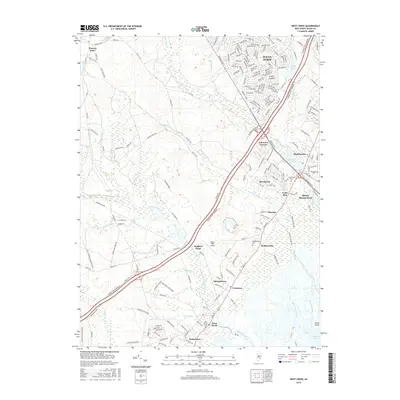
2016 Map of West Creek
USGS Topo · Published 2016About this map
Westecunk Creek and Cedar Run wind through the salt marshes and pine barrens of southern Ocean County in this recent survey. The landscape is defined by its transition from inland forests to the coastal bay, featuring a network of old roads like Grays Rd and Micaja S Rd that hint at the region's early rural connectivity. Modern developments such as Ocean Acres and Beach Haven West contrast with the long-established footprints of Stafford Forge and the riverside settlement of West Creek. Genealogists will find value in the precise locations of the West Creek Cem, Staffordville Cem, and Greenwood Cem. Notable landmarks including the Eagles Nest Airport and the expansive Bass River State Forest illustrate the area's mix of private development and public conservation near Manahawkin Lake.
Find a feature on this map
195 named features on this map. Tap any name to fly to it.
Don’t see what you’re looking for? This feature index may not catch every label — zoom into the map to look around manually.
Map Details
Editions of this 2016 West Creek Map
This is the sole edition of this map. No revisions or reprints were ever made.
Other maps of this area

1884 · Whitings
USGS Topo · 1:62,500

1888 · Barnegat
USGS Topo · 1:62,500

1888 · Little Egg Harbor
USGS Topo · 1:62,500

1888 · Long Beach
USGS Topo · 1:62,500

1888 · Whitings
USGS Topo · 1:62,500

1893 · Little Egg Harbor
USGS Topo · 1:62,500

1893 · Long Beach
USGS Topo · 1:62,500

1893 · Barnegat
USGS Topo · 1:62,500

1898 · Barnegat
USGS Topo · 1:62,500

1919 · Long Beach
USGS Topo · 1:62,500
Featured Places
- Stafford Township, NJ
- Barnegat Township, NJ
- Little Egg Harbor Township, NJ
- Eagleswood Township, NJ
- Coxstown, Eagleswood Township