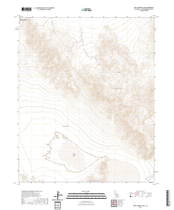
2021 Map of West Cronise Lake
USGS Topo · Published 2021About this map
West Cronise Lake sits at the center of this 2021 study, representing a significant ephemeral water feature in the arid Mojave Desert. The landscape is dominated by the striking elevation changes between the desert floor and the surrounding peaks of the Soda Mountains to the east and the Cronise Mountains to the south. This modern survey illustrates the persistent geomorphology of the region, where the dry lake bed serves as a terminal basin for local drainage. The map provides a precise layout of the Public Land Survey System, showing the township and range divisions of t13n r6e and t12n r6e, which are essential for identifying historical land claims and modern environmental management boundaries in this uninhabited portion of San Bernardino County.
Find a feature on this map
8 named features on this map. Tap any name to fly to it.
Don’t see what you’re looking for? This feature index may not catch every label — zoom into the map to look around manually.
Map Details
Editions of this 2021 West Cronise Lake Map
This is the sole edition of this map. No revisions or reprints were ever made.
Other maps of this area

1933 · Avawatz Mountains
USGS Topo · 1:250,000

1947 · Trona
USGS Topo · 1:250,000

1948 · Red Pass Lake
USGS Topo · 1:62,500

1948 · Trona
USGS Topo · 1:250,000

1948 · Cave Mountain
USGS Topo · 1:62,500

1951 · Cave Mountain
USGS Topo · 1:62,500

1951 · Red Pass Lake
USGS Topo · 1:62,500

1953 · Trona
USGS Topo · 1:250,000
1956 · Soda Lake
USGS Topo · 1:62,500

1956 · Baker
USGS Topo · 1:62,500