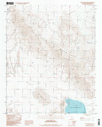
1996 Map of West Cronise Lake
USGS Topo · Published 1998About this map
West Cronise Lake and East Cronise Lake define this arid landscape within the Cronise Valley, situated between the towering Soda Mountains to the north and the Cronise Mountains to the south. This 1996 provisional study, based on aerial photography from the 1980s, captures the high-desert terrain of San Bernardino County before shifting modern climate patterns or increased recreation altered the fragile playas. The map detail highlights the stark contrast between the flat, expansive lake beds and the complex topography of the surrounding ranges, interconnected only by sparse 4wd tracks. It serves as a precise record of the Mojave Desert’s geomorphology, tracing the natural basins and drainage patterns that characterize this remote corridor.
Find a feature on this map
8 named features on this map. Tap any name to fly to it.
Don’t see what you’re looking for? This feature index may not catch every label — zoom into the map to look around manually.
Map Details
Editions of this 1996 West Cronise Lake Map
This is the sole edition of this map. No revisions or reprints were ever made.
Other maps of this area

1933 · Avawatz Mountains
USGS Topo · 1:250,000

1947 · Trona
USGS Topo · 1:250,000

1948 · Red Pass Lake
USGS Topo · 1:62,500

1948 · Trona
USGS Topo · 1:250,000

1948 · Cave Mountain
USGS Topo · 1:62,500

1951 · Cave Mountain
USGS Topo · 1:62,500

1951 · Red Pass Lake
USGS Topo · 1:62,500

1953 · Trona
USGS Topo · 1:250,000
1956 · Soda Lake
USGS Topo · 1:62,500

1956 · Baker
USGS Topo · 1:62,500