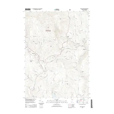
2015 Map of West Dover
USGS Topo · Published 2015About this map
The North Branch Deerfield River valley serves as the primary corridor for West Dover, Vermont, where the landscape is defined by the high ridges of the Green Mountain National Forest. This 2015 survey details a region characterized by small hamlets like Goose City, Brookside, and East Dover, interconnected by a complex network of named mountain roads and trails. The terrain rises sharply from the riverbanks to peaks such as Whites Hill and Rice Hill, while the southern reaches are dominated by Lake Raponda and the Deerfield Valley Regional Airport. For those looking into the area's family history, the map provides precise locations for several burial grounds, including the West Dover Village Cem, Hathaway Cem, and the remote Timson Moore Cem tucked near the eastern boundary.
Find a feature on this map
124 named features on this map. Tap any name to fly to it.
Don’t see what you’re looking for? This feature index may not catch every label — zoom into the map to look around manually.
Map Details
Editions of this 2015 West Dover Map
This is the sole edition of this map. No revisions or reprints were ever made.
Other maps of this area

1889 · Wilmington
USGS Topo · 1:62,500

1891 · Wilmington
USGS Topo · 1:62,500

1891 · Brattleboro
USGS Topo · 1:62,500

1893 · Brattleboro
USGS Topo · 1:62,500

1894 · Londonderry
USGS Topo · 1:62,500

1899 · Londonderry
USGS Topo · 1:62,500

1899 · Wilmington
USGS Topo · 1:62,500

1930 · Saxtons River
USGS Topo · 1:48,000

1932 · Brattleboro
USGS Topo · 1:48,000

1933 · Saxtons River
USGS Topo · 1:62,500