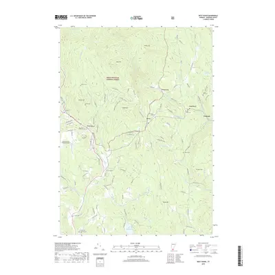
2018 Map of West Dover
USGS Topo · Published 2018About this map
West Dover and East Dover anchor this portion of Windham County, where the settlement pattern follows the narrow valleys of the North Branch Deerfield River and its numerous tributaries. Much of the western and northern terrain is occupied by the Green Mountain National Forest, rising to prominent heights such as Whites Hill and Rice Hill. The map provides significant detail for genealogists, with ten distinct burial sites including the Hathaway Cem, Timson Moore Cem, and the Dover Center Cem. Local infrastructure is marked by the Deerfield Valley Regional Airport and a dense network of mountain roads like Jockey Hollow Rd and Higley Hill Rd. To the south, Lake Raponda serves as a major water feature, surrounded by seasonal and permanent roads that reflect the area's transition from an early hill-farming economy to a modern recreational landscape.
Find a feature on this map
115 named features on this map. Tap any name to fly to it.
Don’t see what you’re looking for? This feature index may not catch every label — zoom into the map to look around manually.
Map Details
Editions of this 2018 West Dover Map
This is the sole edition of this map. No revisions or reprints were ever made.
Other maps of this area

1889 · Wilmington
USGS Topo · 1:62,500

1891 · Wilmington
USGS Topo · 1:62,500

1891 · Brattleboro
USGS Topo · 1:62,500

1893 · Brattleboro
USGS Topo · 1:62,500

1894 · Londonderry
USGS Topo · 1:62,500

1899 · Londonderry
USGS Topo · 1:62,500

1899 · Wilmington
USGS Topo · 1:62,500

1930 · Saxtons River
USGS Topo · 1:48,000

1932 · Brattleboro
USGS Topo · 1:48,000

1933 · Saxtons River
USGS Topo · 1:62,500