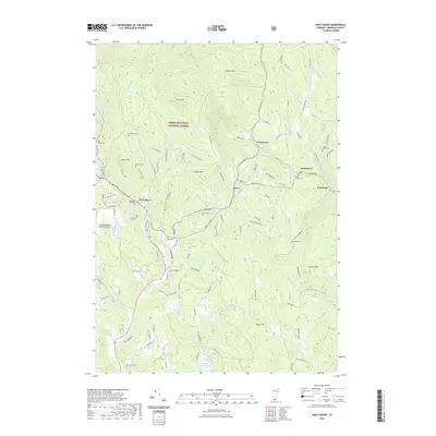
2021 Map of West Dover
USGS Topo · Published 2021About this map
Goose City and the surrounding mountain settlements of Windham County are documented in this recent survey, showcasing a landscape where high-elevation homesteads and modern recreation meet. The map centers on the Dover area, tracing the winding paths of the North Branch Deerfield River and its many tributaries like Rock River and Adams Brook. Much of the northern terrain is preserved within the Green Mountain National Forest, where peaks like Rice Hill and Cooper Hill overlook the valley. For genealogists, the map is particularly detailed, locating numerous small burial grounds such as Hathaway Cem, Rice-Snow Cem, and the Timson Moore Cem. The southern portion of the sheet transitions into a recreational hub near Lake Raponda and the Deerfield Valley Regional Airport, balancing the town's rural heritage with its role as a contemporary Vermont destination.
Find a feature on this map
116 named features on this map. Tap any name to fly to it.
Don’t see what you’re looking for? This feature index may not catch every label — zoom into the map to look around manually.
Map Details
Editions of this 2021 West Dover Map
This is the sole edition of this map. No revisions or reprints were ever made.
Other maps of this area

1889 · Wilmington
USGS Topo · 1:62,500

1891 · Wilmington
USGS Topo · 1:62,500

1891 · Brattleboro
USGS Topo · 1:62,500

1893 · Brattleboro
USGS Topo · 1:62,500

1894 · Londonderry
USGS Topo · 1:62,500

1899 · Londonderry
USGS Topo · 1:62,500

1899 · Wilmington
USGS Topo · 1:62,500

1930 · Saxtons River
USGS Topo · 1:48,000

1932 · Brattleboro
USGS Topo · 1:48,000

1933 · Saxtons River
USGS Topo · 1:62,500