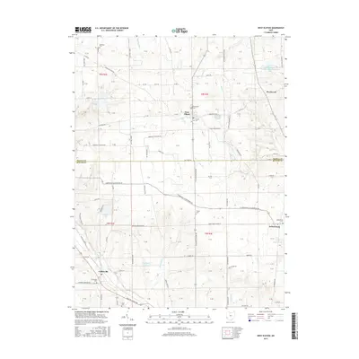
2016 Map of West Elkton
USGS Topo · Published 2016About this map
West Elkton and the surrounding agricultural lands along the border of Preble and Butler Counties define this landscape. The settlement pattern is anchored by small crossroads communities such as Jacksonburg and Collinsville, each maintaining its own distinct character through local landmarks and cemeteries. Numerous family-named roads like Wayne Trace Rd and Mendenhall Rd crisscross the terrain, reflecting the long-standing land ownership and genealogy of the region.
Find a feature on this map
72 named features on this map. Tap any name to fly to it.
Don’t see what you’re looking for? This feature index may not catch every label — zoom into the map to look around manually.
Map Details
Editions of this 2016 West Elkton Map
This is the sole edition of this map. No revisions or reprints were ever made.
Other maps of this area

1904 · Mason
USGS Topo · 1:62,500

1906 · Mason
USGS Topo · 1:62,500

1908 · Miamisburg
USGS Topo · 1:62,500

1911 · Oxford
USGS Topo · 1:62,500

1915 · Hamilton
USGS Topo · 1:62,500

1917 · Hamilton
USGS Topo · 1:62,500

1953 · Cincinnati
USGS Topo · 1:250,000

1955 · Hamilton
USGS Topo · 1:24,000
1955 · Trenton
USGS Topo · 1:24,000
1955 · Millville
USGS Topo · 1:24,000