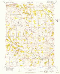
1955 Map of Millville
USGS Topo · Published 1956About this map
Darrtown and Millville anchor this mid-1950s survey of Butler County, where the agricultural landscape is carved by the winding courses of Fourmile Creek and Indian Creek. The region's development is closely tied to the Baltimore and Ohio railroad line, which passes through McGonigle and Woods Station. This era shows a community defined by its rural institutions, including the Hanover Sch and Queen of Peace Sch, alongside numerous family and church burial grounds like Bethel Cem and Minton Cem. The terrain transitions from the upland flats near Auburn to the more dissected valleys around Bunker Hill. To the northeast, the outskirts of Oxford appear, while the residential pocket of Queen Acres signals mid-century growth near the historic village centers. Local landmarks like Island Pond and Holiday Lake offer distinct water features within the predominantly township-sectioned interior.
Find a feature on this map
45 named features on this map. Tap any name to fly to it.
Don’t see what you’re looking for? This feature index may not catch every label — zoom into the map to look around manually.
Map Details
Editions of this 1955 Millville Map
4 editions found
Other maps of this area

1911 · Oxford
USGS Topo · 1:62,500

1915 · College Corner
USGS Topo · 1:48,000

1915 · Harrison
USGS Topo · 1:48,000

1915 · Hamilton
USGS Topo · 1:62,500

1917 · Hamilton
USGS Topo · 1:62,500

1918 · College Corner
USGS Topo · 1:62,500

1953 · Cincinnati
USGS Topo · 1:250,000

1955 · Harrison
USGS Topo · 1:24,000

1955 · Hamilton
USGS Topo · 1:24,000

1955 · Reily
USGS Topo · 1:24,000