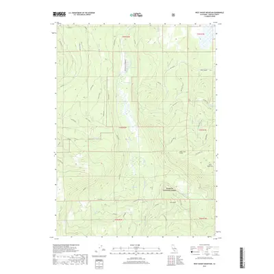
2018 Map of West Haight Mountain
USGS Topo · Published 2018About this map
Klamath National Forest dominates this section of the Cascade Range, defined by high-elevation peaks and a complex network of seasonal water sources. The landscape is anchored by massive topographic features including Whaleback Mtn and West Haight Mtn, which straddle the Alder Creek Divide. This 2018 survey reveals a terrain defined by forestry and fire management, where numerous named springs like Double Spring and Onion Spring feed drainages such as Butte Cr and Pomeroy Cr. The presence of Old Highway and various service routes like Blue Fire and Woodcutter indicate a history of timber access and fire suppression infrastructure. Notable landmarks such as Ulcer Point and Lucy Babe offer distinct reference points for researchers studying the high-country geography of Siskiyou County.
Find a feature on this map
51 named features on this map. Tap any name to fly to it.
Don’t see what you’re looking for? This feature index may not catch every label — zoom into the map to look around manually.
Map Details
Editions of this 2018 West Haight Mountain Map
This is the sole edition of this map. No revisions or reprints were ever made.
Other maps of this area

1886 · Modoc Lava Bed
USGS Topo · 1:250,000

1886 · Shasta
USGS Topo · 1:250,000

1892 · Modoc Lava-Bed
USGS Topo · 1:250,000

1894 · Shasta
USGS Topo · 1:250,000

1932 · Bartle
USGS Topo · 1:96,000

1934 · Macdoel
USGS Topo · 1:96,000

1935 · Dunsmuir
USGS Topo · 1:125,000

1939 · Bartle
USGS Topo · 1:125,000

1941 · Macdoel
USGS Topo · 1:125,000

1948 · Weed
USGS Topo · 1:250,000