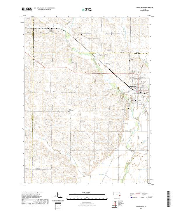
2022 Map of West Liberty
USGS Topo · Published 2022About this map
West Liberty and Downey serve as the primary hubs in this agricultural landscape spanning the borders of Muscatine, Cedar, and Johnson counties. The region is defined by a sophisticated network of water management and rural landmarks, notably several denominational and community burial grounds including Oak Ridge Cem, South Prairie Cem, and Mount Calvary Cem. These sites, scattered across the township lines of t78n r4w and t79n r4w, provide essential geographic anchors for genealogical research.
Find a feature on this map
59 named features on this map. Tap any name to fly to it.
Don’t see what you’re looking for? This feature index may not catch every label — zoom into the map to look around manually.
Map Details
Editions of this 2022 West Liberty Map
This is the sole edition of this map. No revisions or reprints were ever made.
Other maps of this area

1891 · Wilton Junction
USGS Topo · 1:62,500

1894 · West Liberty
USGS Topo · 1:62,500

1901 · Stanwood
USGS Topo · 1:125,000

1948 · Muscatine
USGS Topo · 1:62,500

1958 · Davenport
USGS Topo · 1:250,000

1961 · Davenport
USGS Topo · 1:250,000

1962 · Davenport
USGS Topo · 1:250,000
1965 · West Liberty
USGS Topo · 1:24,000
1965 · Muscatine NW
USGS Topo · 1:24,000
1965 · Atalissa
USGS Topo · 1:24,000