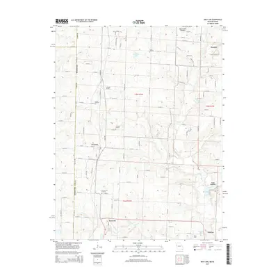
2015 Map of West Line
USGS Topo · Published 2015About this map
Cleveland and the nearby village of West Line anchor this western Cass County landscape where the Missouri border meets the Kansas line. The topography is defined by the winding course of the S Grand River and its tributaries, including East Cr and Poney Cr. This 2015 survey shows a rural environment transitioning toward residential growth, evidenced by the development of Riverview Estates and the presence of small private airfields like Williams Airport and Veach Field.
Find a feature on this map
97 named features on this map. Tap any name to fly to it.
Don’t see what you’re looking for? This feature index may not catch every label — zoom into the map to look around manually.
Map Details
Editions of this 2015 West Line Map
This is the sole edition of this map. No revisions or reprints were ever made.
Other maps of this area

1887 · Harrisonville
USGS Topo · 1:125,000

1887 · Olathe
USGS Topo · 1:125,000

1892 · Harrisonville
USGS Topo · 1:125,000

1893 · Olathe
USGS Topo · 1:125,000

1894 · Harrisonville
USGS Topo · 1:125,000

1947 · Lawrence
USGS Topo · 1:250,000

1950 · Lawrence
USGS Topo · 1:250,000
1953 · Belton
USGS Topo · 1:24,000

1953 · Freeman
USGS Topo · 1:24,000

1953 · West Line
USGS Topo · 1:24,000