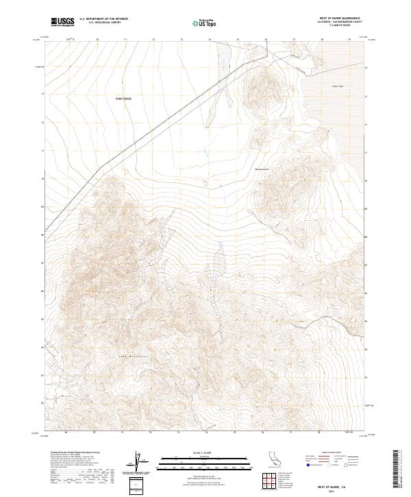
2021 Map of West of Baker
USGS Topo · Published 2021About this map
Soda Mountains topography dominates this section of the Mojave Desert, where the high ground transitions into the dry lakebeds of the basin. The northern portion of the map is defined by the expanse of Silver Lake, a playa that sits as a focal point for local drainage, including the intermittent flow of Salt Creek. This area illustrates the characteristic desert drainage patterns where ephemeral streams descend from the surrounding ridges toward the flat, mineral-rich lake bed. Transportation through this arid landscape is limited to established routes like Silver Lake Rd and Powerline Rd, which follow the natural contours of the valley floor between the mountain ranges.
Find a feature on this map
11 named features on this map. Tap any name to fly to it.
Don’t see what you’re looking for? This feature index may not catch every label — zoom into the map to look around manually.
Map Details
Editions of this 2021 West of Baker Map
This is the sole edition of this map. No revisions or reprints were ever made.
Other maps of this area

1933 · Avawatz Mountains
USGS Topo · 1:250,000

1947 · Trona
USGS Topo · 1:250,000

1948 · Red Pass Lake
USGS Topo · 1:62,500

1948 · Trona
USGS Topo · 1:250,000

1948 · Cave Mountain
USGS Topo · 1:62,500

1951 · Cave Mountain
USGS Topo · 1:62,500

1951 · Red Pass Lake
USGS Topo · 1:62,500

1953 · Trona
USGS Topo · 1:250,000
1956 · Soda Lake
USGS Topo · 1:62,500

1956 · Baker
USGS Topo · 1:62,500