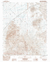
1983 Map of West of Baker
USGS Topo · Published 1983About this map
Silurian Valley and the Soda Mountains dominate this Mojave Desert landscape, captured in a period of transition as modern infrastructure intersected with traditional mining interests. The arid expanse is anchored by the desert basin of Silver Lake, shown here as a Dry Lake. This seasonal water system contrasts with the industrial presence of Steel Transmission Lines and a prominent Tower cutting across the valley floor. Evidence of the region's extraction history appears through scattered prospects and a Gravel Pit, while the high elevations of Cooper Mtn and Soda Mtn provide the physical barriers that define the local geography. The map reflects the 1980s-era topographical survey work by the U.S. Geological Survey and Nos/Noaa, documenting a largely uninhabited but surveyed section of San Bernardino County.
Find a feature on this map
12 named features on this map. Tap any name to fly to it.
Don’t see what you’re looking for? This feature index may not catch every label — zoom into the map to look around manually.
Map Details
Editions of this 1983 West of Baker Map
This is the sole edition of this map. No revisions or reprints were ever made.
Other maps of this area

1933 · Avawatz Mountains
USGS Topo · 1:250,000

1947 · Trona
USGS Topo · 1:250,000

1948 · Red Pass Lake
USGS Topo · 1:62,500

1948 · Trona
USGS Topo · 1:250,000

1948 · Cave Mountain
USGS Topo · 1:62,500

1951 · Cave Mountain
USGS Topo · 1:62,500

1951 · Red Pass Lake
USGS Topo · 1:62,500

1953 · Trona
USGS Topo · 1:250,000
1956 · Soda Lake
USGS Topo · 1:62,500

1956 · Baker
USGS Topo · 1:62,500