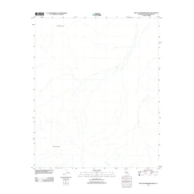
2012 Map of West of Budweiser Wash
USGS Topo · Published 2012About this map
The Bristol Mountains dominate the arid topography of this San Bernardino County desert landscape, as charted by the U.S. Geological Survey in 2012. This region is characterized by ephemeral drainages and vast alluvial fans, most notably the prominent Siberia Wash which cuts through the southeastern corner of the quadrangle. The lack of man-made structures, roads, or settlements within this specific boundary highlights the primitive and undeveloped state of the Mojave Desert in the early 21st century. Instead, the map provides a high-resolution study of natural desert landforms, illustrating how seasonal water flow from the higher elevations of the Bristol Mountains has shaped the surrounding drainage basins over millennia.
Find a feature on this map
2 named features on this map. Tap any name to fly to it.
Don’t see what you’re looking for? This feature index may not catch every label — zoom into the map to look around manually.
Map Details
Editions of this 2012 West of Budweiser Wash Map
This is the sole edition of this map. No revisions or reprints were ever made.
Other maps of this area

1942 · Amboy
USGS Topo · 1:250,000

1943 · Amboy
USGS Topo · 1:250,000

1953 · San Bernardino
USGS Topo · 1:250,000

1954 · Needles
USGS Topo · 1:250,000

1955 · Ash Hill
USGS Topo · 1:24,000

1955 · Broadwell Lake
USGS Topo · 1:62,500

1955 · Ludlow
USGS Topo · 1:62,500

1956 · San Bernardino
USGS Topo · 1:250,000

1956 · Needles
USGS Topo · 1:250,000
1956 · Bagdad
USGS Topo · 1:62,500