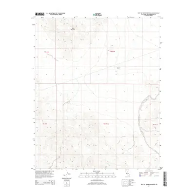
2015 Map of West of Budweiser Wash
USGS Topo · Published 2015About this map
The Bristol Mountains dominate the northern landscape of this San Bernardino County quadrangle, situated within the arid expanse of the Mojave Desert. This 2015 survey by the U.S. Geological Survey maps a region defined by its extreme topography and hydrological features, notably the Siberia Wash which drains through the southern sections. The map provides a detailed view of the Public Land Survey System (PLSS) grid, documenting townships like t9n r9e, t9n r10e, and t8n r10e. These survey lines trace the desert's administrative history across a landscape largely void of permanent settlements, showing the intersection of natural landforms and the legal boundaries established for land management in this remote part of Southern California.
Find a feature on this map
8 named features on this map. Tap any name to fly to it.
Don’t see what you’re looking for? This feature index may not catch every label — zoom into the map to look around manually.
Map Details
Editions of this 2015 West of Budweiser Wash Map
This is the sole edition of this map. No revisions or reprints were ever made.
Other maps of this area

1942 · Amboy
USGS Topo · 1:250,000

1943 · Amboy
USGS Topo · 1:250,000

1953 · San Bernardino
USGS Topo · 1:250,000

1954 · Needles
USGS Topo · 1:250,000

1955 · Ash Hill
USGS Topo · 1:24,000

1955 · Broadwell Lake
USGS Topo · 1:62,500

1955 · Ludlow
USGS Topo · 1:62,500

1956 · San Bernardino
USGS Topo · 1:250,000

1956 · Needles
USGS Topo · 1:250,000
1956 · Bagdad
USGS Topo · 1:62,500