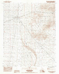
1984 Map of West of Flattop Mtn
USGS Topo · Published 1984About this map
Ward Valley forms a broad, arid basin through the center of this San Bernardino County landscape, defined by a network of drainage channels labeled simply as Wash. The terrain is dominated to the east by the rising slopes of the Sacramento Mountains, where South Pass provides a navigable corridor through the higher elevations. This 1980s-era survey documents the industrial and logistical infrastructure of the Mojave desert, featuring a Fenced Substa and extensive Steel Tower Transmission Lines that bisect the desert floor. Aviation history is noted by the presence of the Homer Landing Strip, while small-scale mineral exploration is marked by a lone Prospect and nearby Spoil Banks. The map provides a clear record of resource transportation, showing several Underground Petroleum Pipelines cutting across the valley floor.
Find a feature on this map
12 named features on this map. Tap any name to fly to it.
Don’t see what you’re looking for? This feature index may not catch every label — zoom into the map to look around manually.
Map Details
Editions of this 1984 West of Flattop Mtn Map
This is the sole edition of this map. No revisions or reprints were ever made.
Other maps of this area

1942 · Amboy
USGS Topo · 1:250,000

1943 · Center Hills
USGS Topo · 1:62,500

1943 · Amboy
USGS Topo · 1:250,000

1943 · Essex
USGS Topo · 1:62,500

1943 · Fenner
USGS Topo · 1:62,500

1943 · Bannock
USGS Topo · 1:62,500

1954 · Needles
USGS Topo · 1:250,000

1956 · Needles
USGS Topo · 1:250,000

1956 · Fenner
USGS Topo · 1:62,500

1956 · Essex
USGS Topo · 1:62,500