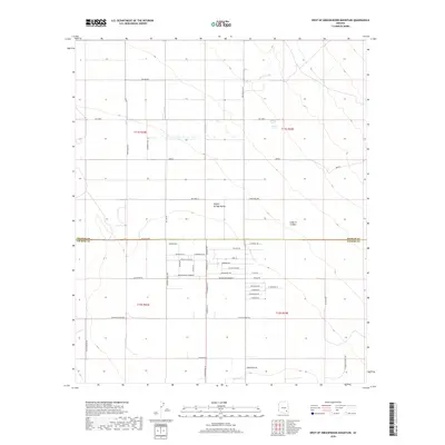
2018 Map of West of Greasewood Mountain
USGS Topo · Published 2018About this map
The Sulphur Springs Valley landscape is defined by its transition from high desert drainage to a grid of rural residential development and agricultural easements. The northern portion of the map is dominated by natural features like Bar X Wash and the drainage of Ash Creek, while the southern half shows the organized expansion of Winchester Heights across the Graham Co and Cochise Co border. This area is heavily structured by long-standing transit routes, notably Fort Grant Rd and its historical counterpart, Old Fort Grant Rd. Local infrastructure is marked by numerous named lanes and easements, such as the Winchester Easement and W Winchester Easement, which provide access to tracts of land beneath the shadow of O Bar O Canyon. The layout of roads like W Reagan Rd and Rascon Rd illustrates the late 20th and early 21st-century habitational pattern typical of this region's desert basins.
Find a feature on this map
51 named features on this map. Tap any name to fly to it.
Don’t see what you’re looking for? This feature index may not catch every label — zoom into the map to look around manually.
Map Details
Editions of this 2018 West of Greasewood Mountain Map
This is the sole edition of this map. No revisions or reprints were ever made.
Other maps of this area

1922 · Willcox
USGS Topo · 1:125,000

1940 · Sierra Bonita Ranch
USGS Topo · 1:62,500

1942 · Sierra Bonita Ranch
USGS Topo · 1:62,500

1942 · Mt. Graham
USGS Topo · 1:62,500

1943 · Willcox
USGS Topo · 1:62,500

1943 · Sierra Bonita Ranch
USGS Topo · 1:62,500

1943 · Winchester Mts.
USGS Topo · 1:62,500

1945 · Mt. Graham
USGS Topo · 1:62,500

1945 · Winchester Mts.
USGS Topo · 1:62,500

1954 · Silver City
USGS Topo · 1:250,000