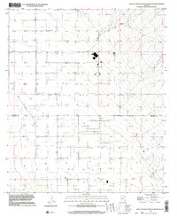
1996 Map of West of Greasewood Mountain
USGS Topo · Published 2003About this map
The Graham and Cochise county border runs through this arid landscape, a region defined by agricultural water management and sparse industrial infrastructure in the late 1970s and 1990s. The terrain is marked by a network of groundwater extraction points, with numerous Wells and several Tanks scattered across the flats to support ranching and farming operations. Surface water is seasonal, evidenced by the ephemeral Ash Creek and Bar Wash, while a series of man-made Ditches indicates the movement of water to cultivated fields.
Find a feature on this map
14 named features on this map. Tap any name to fly to it.
Don’t see what you’re looking for? This feature index may not catch every label — zoom into the map to look around manually.
Map Details
Editions of this 1996 West of Greasewood Mountain Map
This is the sole edition of this map. No revisions or reprints were ever made.
Other maps of this area

1922 · Willcox
USGS Topo · 1:125,000

1940 · Sierra Bonita Ranch
USGS Topo · 1:62,500

1942 · Sierra Bonita Ranch
USGS Topo · 1:62,500

1942 · Mt. Graham
USGS Topo · 1:62,500

1943 · Willcox
USGS Topo · 1:62,500

1943 · Sierra Bonita Ranch
USGS Topo · 1:62,500

1943 · Winchester Mts.
USGS Topo · 1:62,500

1945 · Mt. Graham
USGS Topo · 1:62,500

1945 · Winchester Mts.
USGS Topo · 1:62,500

1954 · Silver City
USGS Topo · 1:250,000