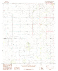
1985 Map of West of Greasewood Mtn
USGS Topo · Published 1985About this map
Ash Creek and Bar Wash define the drainage patterns of this high-desert landscape situated along the border of Graham and Cochise counties. This 1980s provisional survey documents a transition toward rural utility and agricultural infrastructure, evidenced by the presence of Storage Bins and a Sub Station. The terrain is marked by numerous wells and a notable Ditch system, reflecting the water management necessary for this arid region. The map provides a clear look at the property divisions and infrastructure that supported local ranching and farming operations during the late twentieth century, just before digital mapping became the standard for topographic recording.
Find a feature on this map
7 named features on this map. Tap any name to fly to it.
Don’t see what you’re looking for? This feature index may not catch every label — zoom into the map to look around manually.
Map Details
Editions of this 1985 West of Greasewood Mtn Map
This is the sole edition of this map. No revisions or reprints were ever made.
Other maps of this area

1922 · Willcox
USGS Topo · 1:125,000

1940 · Sierra Bonita Ranch
USGS Topo · 1:62,500

1942 · Sierra Bonita Ranch
USGS Topo · 1:62,500

1942 · Mt. Graham
USGS Topo · 1:62,500

1943 · Willcox
USGS Topo · 1:62,500

1943 · Sierra Bonita Ranch
USGS Topo · 1:62,500

1943 · Winchester Mts.
USGS Topo · 1:62,500

1945 · Mt. Graham
USGS Topo · 1:62,500

1945 · Winchester Mts.
USGS Topo · 1:62,500

1954 · Silver City
USGS Topo · 1:250,000