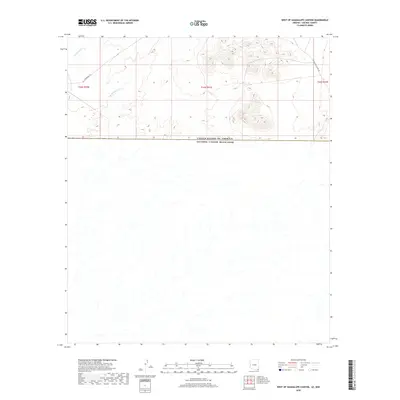
2018 Map of West of Guadalupe Canyon
USGS Topo · Published 2018About this map
The international border between the United States of America and Mexico bisects this remote corridor of Cochise County, tracking across a landscape defined by seasonal drainages and early travel routes. Historical movement through this arid territory is marked by the Geronimo Trl, which winds through the northwestern corner of the map, while the Guadalupe Canyon Rd provides access to the eastern canyons. Water is a defining yet transient force here, evidenced by the courses of Cottonwood Cr and Hay Hollow Wash, which drain the elevated terrain in the northern sections. This 2018 survey detail provides a clear look at the topographic contours and the precise alignment of the international boundary line where Arizona meets Sonora.
Find a feature on this map
8 named features on this map. Tap any name to fly to it.
Don’t see what you’re looking for? This feature index may not catch every label — zoom into the map to look around manually.
Map Details
Editions of this 2018 West of Guadalupe Canyon Map
This is the sole edition of this map. No revisions or reprints were ever made.
Other maps of this area

1919 · Perilla
USGS Topo · 1:125,000

1922 · McDonald
USGS Topo · 1:62,500

1940 · College Peaks
USGS Topo · 1:62,500

1955 · Douglas
USGS Topo · 1:250,000

1958 · Guadalupe Canyon
USGS Topo · 1:62,500
1958 · College Peaks
USGS Topo · 1:62,500

1959 · Douglas
USGS Topo · 1:250,000

1961 · Douglas
USGS Topo · 1:250,000

1964 · Douglas
USGS Topo · 1:250,000
1985 · San Bernardino Ranch
USGS Topo · 1:24,000