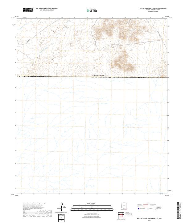
2021 Map of West of Guadalupe Canyon
USGS Topo · Published 2021About this map
The international border between the United States of America and Estados Unidos Mexicanos defines the lower third of this Cochise County landscape. The terrain north of the boundary is marked by high-desert drainage systems, including Cottonwood Cr and the broadly branching Hay Hollow Wash. Human presence is primarily defined by two historic transportation routes: Geronimo Trl, which traverses the northwestern corner, and Guadalupe Canyon Rd, which cuts across the northeastern reaches. This map illustrates the intersection of natural topography and political boundaries in a sparsely settled ranching region, where the Public Land Survey System divisions of t24s r30e, t24s r31e, and t24s r32e organize the arid landscape.
Find a feature on this map
9 named features on this map. Tap any name to fly to it.
Don’t see what you’re looking for? This feature index may not catch every label — zoom into the map to look around manually.
Map Details
Editions of this 2021 West of Guadalupe Canyon Map
This is the sole edition of this map. No revisions or reprints were ever made.
Other maps of this area

1919 · Perilla
USGS Topo · 1:125,000

1922 · McDonald
USGS Topo · 1:62,500

1940 · College Peaks
USGS Topo · 1:62,500

1955 · Douglas
USGS Topo · 1:250,000

1958 · Guadalupe Canyon
USGS Topo · 1:62,500
1958 · College Peaks
USGS Topo · 1:62,500

1959 · Douglas
USGS Topo · 1:250,000

1961 · Douglas
USGS Topo · 1:250,000

1964 · Douglas
USGS Topo · 1:250,000
1985 · San Bernardino Ranch
USGS Topo · 1:24,000