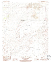
1985 Map of West of Guadalupe Canyon
USGS Topo · Published 1986About this map
The international boundary between the United States and Mexico bisects this high-desert landscape in southeastern Cochise County. In the mid-1980s, the region was characterized by its complex mesa systems and seasonal drainage patterns, most notably the prominent San Bernardino area and the sprawling Mesa El Agua Verde. Named landmarks like El Toro and El Fist reflect the cultural heritage of this borderland, while features such as El Represo indicate the essential water management required in an arid environment. The map details the transition from the relatively flat reaches of El Zacatonal and Los Janos into the sharper relief of Mesa Guadalupe and Mesa La Nopalera, providing a snapshot of the terrain as it existed before contemporary border developments changed the visual character of the corridor.
Find a feature on this map
22 named features on this map. Tap any name to fly to it.
Don’t see what you’re looking for? This feature index may not catch every label — zoom into the map to look around manually.
Map Details
Editions of this 1985 West of Guadalupe Canyon Map
This is the sole edition of this map. No revisions or reprints were ever made.
Other maps of this area

1919 · Perilla
USGS Topo · 1:125,000

1922 · McDonald
USGS Topo · 1:62,500

1940 · College Peaks
USGS Topo · 1:62,500

1955 · Douglas
USGS Topo · 1:250,000

1958 · Guadalupe Canyon
USGS Topo · 1:62,500
1958 · College Peaks
USGS Topo · 1:62,500

1959 · Douglas
USGS Topo · 1:250,000

1961 · Douglas
USGS Topo · 1:250,000

1964 · Douglas
USGS Topo · 1:250,000
1985 · San Bernardino Ranch
USGS Topo · 1:24,000