
1993 Map of West of Johnson Bayou
USGS Topo · Published 1993About this map
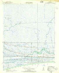
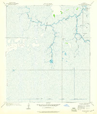
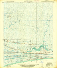
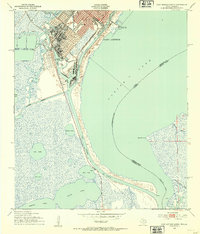
Sabine Lake dominates the northwestern horizon of this coastal landscape, where the transition from water to land is defined by a series of prominent cheniers. These ridges, including Garrison Ridge, Blue Buck Ridge, and Sanders Ridge, provide the only firm ground amidst an extensive system of marshes and bayous. The map documents the intricate hydrology of the area, featuring Madame Johnson Bayou Lake and the winding course of Johnson Bayou as it moves toward the gulf. This environment supported the Sabine National Wildlife Refuge and historical land use patterns evidenced by the Old Military Reservation boundary and the remote Johnson Bayou Landing. The network of pipelines and levees crossing the wetlands reflects the industrial infrastructure necessary to navigate and manage this unique Louisiana chenier plain.
Find a feature on this map
28 named features on this map. Tap any name to fly to it.
Don’t see what you’re looking for? This feature index may not catch every label — zoom into the map to look around manually.
Map Details
Editions of this 1993 West of Johnson Bayou Map
This is the sole edition of this map. No revisions or reprints were ever made.
Other maps of this area

1932 · Sabine Pass NE
USGS Topo · 1:31,680

1932 · Port Arthur NE
USGS Topo · 1:31,680
1934 · Johnsons Bayou
USGS Topo · 1:24,000
1934 · Greens Bayou
USGS Topo · 1:24,000

1935 · Greens Bayou
USGS Topo · 1:31,680
1935 · Johnsons Bayou
USGS Topo · 1:31,680

1943 · West of Johnson Bayou
USGS Topo · 1:24,000

1943 · West of Greens Bayou
USGS Topo · 1:24,000

1943 · Port Arthur North
USGS Topo · 1:24,000
1943 · Port Arthur South
USGS Topo · 1:24,000