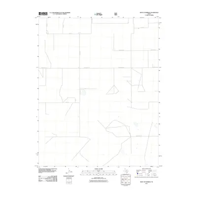
2011 Map of West of Kerrick
USGS Topo · Published 2011About this map
Dallam County’s northern Panhandle landscape appears as a highly organized grid of rural ranch and access roads in this 2011 survey. The territory is defined by long, straight thoroughfares that follow the section lines of the Texas high plains, including Hermit Rd and Hampton Rd. These routes serve scattered agricultural operations and homesteads, linked by named paths such as Schoonover Ln and Minnie Mack Ln. The layout reflects the enduring influence of the Public Land Survey System on the region's development, where water management features like small playa lakes or catchments are the primary relief in an otherwise strictly partitioned terrain. Local family names are preserved through the naming of corridors like Whittenburg Ln and Wells Ln, providing a clear record of land use and property boundaries in this corner of Northwest Texas.
Find a feature on this map
10 named features on this map. Tap any name to fly to it.
Don’t see what you’re looking for? This feature index may not catch every label — zoom into the map to look around manually.
Map Details
Editions of this 2011 West of Kerrick Map
This is the sole edition of this map. No revisions or reprints were ever made.
Other maps of this area

1954 · Dalhart
USGS Topo · 1:250,000

1958 · Dalhart
USGS Topo · 1:250,000

1962 · Dalhart
USGS Topo · 1:250,000

1964 · Brickel
USGS Topo · 1:24,000

1964 · Kerrick
USGS Topo · 1:24,000

1964 · Stratford 2 SE
USGS Topo · 1:24,000

1964 · Stratford 2 NE
USGS Topo · 1:24,000

1971 · Griggs SW
USGS Topo · 1:24,000

1971 · Conrad SW
USGS Topo · 1:24,000
1971 · Conrad
USGS Topo · 1:24,000