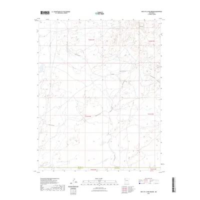
2023 Map of West of La Vida Mission
USGS Topo · Published 2023About this map
White Rock sits in the northeast corner of this high-desert landscape in northwestern New Mexico, where the transition between San Juan Co and McKinley Co occurs. The terrain is defined by the winding course of Indian Creek, which cuts through the arid plateau and drains southward. A network of Bureau of Indian Affairs roads, such as Indian Svc Rte 7060 and Indian Svc Rte 9652, provides the primary infrastructure for this sparsely populated region. These routes often follow the natural contours of the land, avoiding steeper elevations like Red Hill. The map illustrates a landscape of intermittent water features and isolated settlements, reflecting the specialized transportation patterns of the Navajo Nation interior where service routes are vital for connecting distant communities across the high mesas and arroyos.
Find a feature on this map
16 named features on this map. Tap any name to fly to it.
Don’t see what you’re looking for? This feature index may not catch every label — zoom into the map to look around manually.
Map Details
Editions of this 2023 West of La Vida Mission Map
This is the sole edition of this map. No revisions or reprints were ever made.
Other maps of this area

1886 · Wingate
USGS Topo · 1:250,000

1889 · Chaco
USGS Topo · 1:250,000

1892 · Wingate
USGS Topo · 1:250,000

1892 · Chaco
USGS Topo · 1:250,000

1954 · Shiprock
USGS Topo · 1:250,000

1954 · Gallup
USGS Topo · 1:250,000

1958 · Gallup
USGS Topo · 1:250,000

1958 · Shiprock
USGS Topo · 1:250,000

1959 · Shiprock
USGS Topo · 1:250,000

1959 · Gallup
USGS Topo · 1:250,000
Featured Places
- Fort Defiance Agency
- Eastern Navajo Agency, NM
- White Rock, Eastern Navajo Agency
- San Juan County, NM
- McKinley County, NM