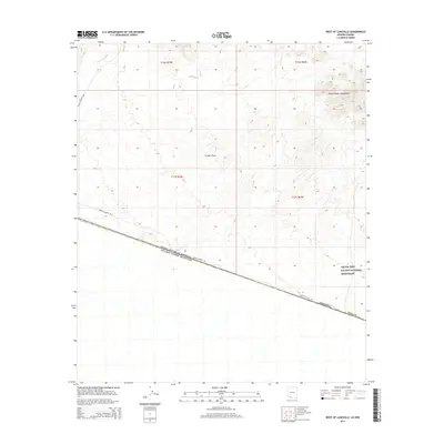
2014 Map of West of Lukeville
USGS Topo · Published 2014About this map
The international border between the United States of America and Estados Unidos Mexicanos cuts diagonally across this desert landscape, separating Pima County, Arizona from Sonora. Much of the northern terrain is dominated by the sprawling Organ Pipe Cactus National Monument, where the Puerto Blanco Mountains rise above the arid expanse of the La Abra Plain. Transport through this protected wilderness is limited to Puerto Blanco Dr, which skirts the border and the southern edges of the mountains. Seasonal drainage patterns are visible through the course of the Aguajita Wash in the northwest, illustrating the complex hydrology of the Sonoran Desert. This map provides a clear view of the geopolitical boundary and the preserved natural features within the monument's western reach.
Find a feature on this map
12 named features on this map. Tap any name to fly to it.
Don’t see what you’re looking for? This feature index may not catch every label — zoom into the map to look around manually.
Map Details
Editions of this 2014 West of Lukeville Map
This is the sole edition of this map. No revisions or reprints were ever made.
Other maps of this area

1953 · Ajo
USGS Topo · 1:250,000

1954 · Sonoyta
USGS Topo · 1:250,000

1957 · Ajo
USGS Topo · 1:250,000

1958 · Ajo
USGS Topo · 1:250,000

1962 · Ajo
USGS Topo · 1:250,000

1963 · Ajo
USGS Topo · 1:250,000

1963 · Lukeville
USGS Topo · 1:62,500

1963 · Quitobaquito Springs
USGS Topo · 1:62,500

1963 · Kino Peak
USGS Topo · 1:62,500

1963 · Lukeville
USGS Topo · 1:250,000