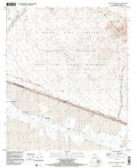
1996 Map of West of Lukeville
USGS Topo · Published 2000About this map
Organ Pipe Cactus National Monument dominates the northern landscape of this Pima County survey, where the Puerto Blanco Mountains rise above the arid expanse of La Abra Plain. The international border between the United States of America and Mexico serves as the central focal point, bisecting the terrain where Arizona and Sonora meet. This 1990s record captures a complex cross-border geography, detailing several Mexican settlements such as Santo Domingo, Josefa Ortiz de Dominguez, and Morelia that sit just south of the line.
Find a feature on this map
24 named features on this map. Tap any name to fly to it.
Don’t see what you’re looking for? This feature index may not catch every label — zoom into the map to look around manually.
Map Details
Editions of this 1996 West of Lukeville Map
This is the sole edition of this map. No revisions or reprints were ever made.
Other maps of this area

1953 · Ajo
USGS Topo · 1:250,000

1954 · Sonoyta
USGS Topo · 1:250,000

1957 · Ajo
USGS Topo · 1:250,000

1958 · Ajo
USGS Topo · 1:250,000

1962 · Ajo
USGS Topo · 1:250,000

1963 · Ajo
USGS Topo · 1:250,000

1963 · Lukeville
USGS Topo · 1:62,500

1963 · Quitobaquito Springs
USGS Topo · 1:62,500

1963 · Kino Peak
USGS Topo · 1:62,500

1963 · Lukeville
USGS Topo · 1:250,000