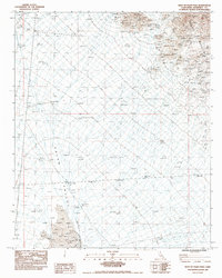
1983 Map of West of Palen Pass
USGS Topo · Published 1983About this map
Granite Mountains dominate the northeastern portion of this arid landscape, giving way to the expansive floor of the Palen Valley. Surveyed in the late 1970s and edited in the early 1980s, the map reveals a remote desert environment defined by shifting Sand Dunes and the drainage patterns of a large Dry Wash. Human infrastructure is sparse, limited to a Single Steel Tower Powerline cutting across the terrain and occasional markers of land management like a Check Dam. The inclusion of the Coxcomb E. Base (2-75A) geodetic point provides a specific anchor for those tracking historical surveying work in Riverside County. The network of an Unimproved Road suggests the difficulty of transit through this valley floor before modern paving reached such isolated stretches of the California desert.
Find a feature on this map
8 named features on this map. Tap any name to fly to it.
Don’t see what you’re looking for? This feature index may not catch every label — zoom into the map to look around manually.
Map Details
Editions of this 1983 West of Palen Pass Map
This is the sole edition of this map. No revisions or reprints were ever made.
Other maps of this area

1942 · Amboy
USGS Topo · 1:250,000

1943 · Amboy
USGS Topo · 1:250,000

1943 · Cadiz Valley
USGS Topo · 1:62,500

1943 · Iron Mountains
USGS Topo · 1:62,500

1943 · Coxcomb Mountains
USGS Topo · 1:62,500

1944 · Coxcomb Mountains
USGS Topo · 1:62,500

1952 · Palen Mountains
USGS Topo · 1:62,500

1954 · Salton Sea
USGS Topo · 1:250,000

1954 · Needles
USGS Topo · 1:250,000

1955 · Salton Sea
USGS Topo · 1:250,000