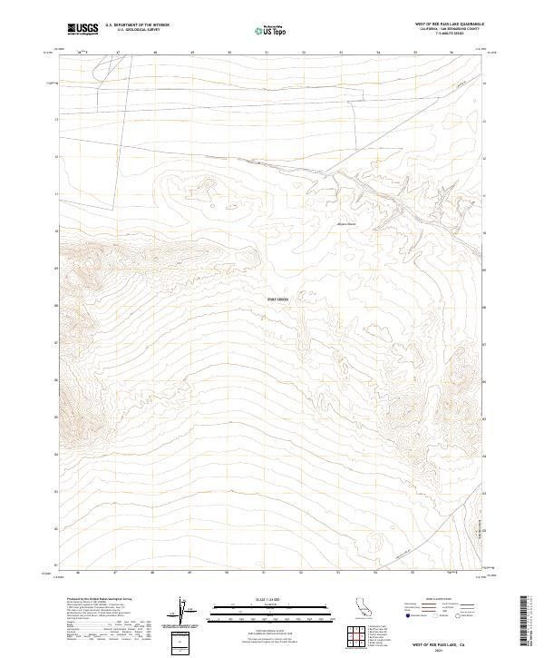
2021 Map of West of Red Pass Lake
USGS Topo · Published 2021About this map
Mojave Desert terrain dominates this expanse of the eastern California desert, characterized by significant elevation changes that transition into the Soda Mountains in the southeastern corner. The landscape is largely defined by its topography rather than settlement, with no permanent towns or buildings indicated within these township boundaries. Movement through this arid region is limited to a few established routes, including Red Pass Lake Rd in the south and E Range Rd in the north. The survey accurately reflects the sparse human footprint in this part of San Bernardino County, where the primary features are the natural contours of the mountain slopes and desert basins rather than residential or industrial development.
Find a feature on this map
12 named features on this map. Tap any name to fly to it.
Don’t see what you’re looking for? This feature index may not catch every label — zoom into the map to look around manually.
Map Details
Editions of this 2021 West of Red Pass Lake Map
This is the sole edition of this map. No revisions or reprints were ever made.
Other maps of this area

1933 · Avawatz Mountains
USGS Topo · 1:250,000

1947 · Trona
USGS Topo · 1:250,000

1948 · Red Pass Lake
USGS Topo · 1:62,500

1948 · Trona
USGS Topo · 1:250,000

1948 · Alvord Mountain
USGS Topo · 1:62,500

1948 · Cave Mountain
USGS Topo · 1:62,500

1948 · Tiefort Mountains
USGS Topo · 1:62,500

1951 · Tiefort Mountains
USGS Topo · 1:62,500

1951 · Cave Mountain
USGS Topo · 1:62,500

1951 · Alvord Mountain
USGS Topo · 1:62,500