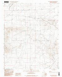
1996 Map of West of Red Pass Lake
USGS Topo · Published 1998About this map
Fort Irwin Military Reservation dominates this desert landscape in the Mojave, where the terrain is defined by dry drainage patterns and significant elevation changes. The southern portion of the map is characterized by the Tiefort Mts, which rise abruptly from the surrounding flats. In the northern sections, a series of man-made Levee structures indicate efforts to manage water flow across the arid environment, where intermittent Wash features are the primary markers of the hydrologic system. This provisional survey captures the intersection of military land use and the natural topography of San Bernardino County during the mid-1990s, focusing on an area where access was strictly controlled and the landscape remained largely undeveloped apart from these specialized infrastructures.
Find a feature on this map
7 named features on this map. Tap any name to fly to it.
Don’t see what you’re looking for? This feature index may not catch every label — zoom into the map to look around manually.
Map Details
Editions of this 1996 West of Red Pass Lake Map
This is the sole edition of this map. No revisions or reprints were ever made.
Other maps of this area

1933 · Avawatz Mountains
USGS Topo · 1:250,000

1947 · Trona
USGS Topo · 1:250,000

1948 · Red Pass Lake
USGS Topo · 1:62,500

1948 · Trona
USGS Topo · 1:250,000

1948 · Alvord Mountain
USGS Topo · 1:62,500

1948 · Cave Mountain
USGS Topo · 1:62,500

1948 · Tiefort Mountains
USGS Topo · 1:62,500

1951 · Tiefort Mountains
USGS Topo · 1:62,500

1951 · Cave Mountain
USGS Topo · 1:62,500

1951 · Alvord Mountain
USGS Topo · 1:62,500