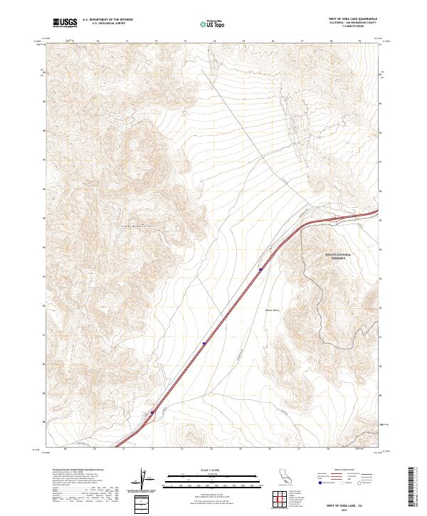
2021 Map of West of Soda Lake
USGS Topo · Published 2021About this map
The Soda Mountains dominate the western portion of this landscape, rising above the arid floor of the Mojave Desert in San Bernardino County. This 2021 survey illustrates the modern configuration of the Mojave National Preserve, which encompasses the eastern half of the map area. The terrain is defined by extreme relief and the isolation typical of this corner of the California desert, where transportation routes are limited to a handful of significant thoroughfares. Historical corridors like the Arrowhead Trl and the uniquely named Zzyzx Rd provide the primary access points through the expansive public lands, while Rasor Rd cuts across the southern township line. The map serves as a contemporary record of the township and range boundaries, including t13n r8e and t12n r7e, illustrating how administrative grids overlay this remote natural environment.
Find a feature on this map
11 named features on this map. Tap any name to fly to it.
Don’t see what you’re looking for? This feature index may not catch every label — zoom into the map to look around manually.
Map Details
Editions of this 2021 West of Soda Lake Map
This is the sole edition of this map. No revisions or reprints were ever made.
Other maps of this area

1933 · Avawatz Mountains
USGS Topo · 1:250,000

1947 · Trona
USGS Topo · 1:250,000

1948 · Red Pass Lake
USGS Topo · 1:62,500

1948 · Trona
USGS Topo · 1:250,000

1948 · Cave Mountain
USGS Topo · 1:62,500

1951 · Cave Mountain
USGS Topo · 1:62,500

1951 · Red Pass Lake
USGS Topo · 1:62,500

1953 · Trona
USGS Topo · 1:250,000
1956 · Soda Lake
USGS Topo · 1:62,500

1956 · Baker
USGS Topo · 1:62,500