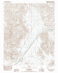
1983 Map of West of Soda Lake
USGS Topo · Published 1983About this map
Soda Mountains define the eastern relief of this arid corridor in the Mojave Desert, where infrastructure and mining take precedence over permanent settlement. The presence of Beacon Station along the southern margin, situated near a Water Tank, underscores the importance of traveler services and water access in this desert environment. Industrial activity is evident through the Blue Bell Mine and a designated Borrow Pit, indicating the extraction of minerals and materials from the surrounding terrain. Long-distance utility lines, including a Power Line and Gas Line, traverse the landscape alongside a prominent Levee, reflecting the large-scale engineering required to manage resources and protection across the open Wash systems. The network of unimproved tracks and the presence of Rasor Road provide a record of regional travel routes used before the modernization of desert thoroughfares.
Find a feature on this map
12 named features on this map. Tap any name to fly to it.
Don’t see what you’re looking for? This feature index may not catch every label — zoom into the map to look around manually.
Map Details
Editions of this 1983 West of Soda Lake Map
This is the sole edition of this map. No revisions or reprints were ever made.
Other maps of this area

1933 · Avawatz Mountains
USGS Topo · 1:250,000

1947 · Trona
USGS Topo · 1:250,000

1948 · Red Pass Lake
USGS Topo · 1:62,500

1948 · Trona
USGS Topo · 1:250,000

1948 · Cave Mountain
USGS Topo · 1:62,500

1951 · Cave Mountain
USGS Topo · 1:62,500

1951 · Red Pass Lake
USGS Topo · 1:62,500

1953 · Trona
USGS Topo · 1:250,000
1956 · Soda Lake
USGS Topo · 1:62,500

1956 · Baker
USGS Topo · 1:62,500