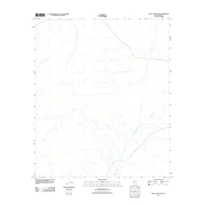
2011 Map of West of Ventana
USGS Topo · Published 2011About this map
San Simon Wash and its complex network of seasonal tributaries define the landscape of this Pima County desert region. This 2011 survey illustrates a sparse infrastructure where the natural drainage patterns of the Sonoran desert dictate the few routes that cross the terrain. Human activity is represented primarily by designated tribal road systems, including Indian Rte 23 and Indian Rte 34, which provide the only reliable transit through this arid territory. The topographic detail focuses on the subtle elevation changes of the desert floor and the drainage basins that feed into Kaka Wash, highlighting the importance of water management and natural geography in a region where surface water is transitory and significant.
Find a feature on this map
4 named features on this map. Tap any name to fly to it.
Don’t see what you’re looking for? This feature index may not catch every label — zoom into the map to look around manually.
Map Details
Editions of this 2011 West of Ventana Map
This is the sole edition of this map. No revisions or reprints were ever made.
Other maps of this area

1941 · Vekol Mountains
USGS Topo · 1:62,500

1942 · Vekol Mountains
USGS Topo · 1:62,500

1953 · Ajo
USGS Topo · 1:250,000

1957 · Ajo
USGS Topo · 1:250,000

1958 · Ajo
USGS Topo · 1:250,000

1958 · Kaka
USGS Topo · 1:62,500

1962 · Ajo
USGS Topo · 1:250,000

1963 · Ajo
USGS Topo · 1:250,000

1963 · Gu Achi
USGS Topo · 1:62,500

1963 · Cimarron Peak
USGS Topo · 1:62,500