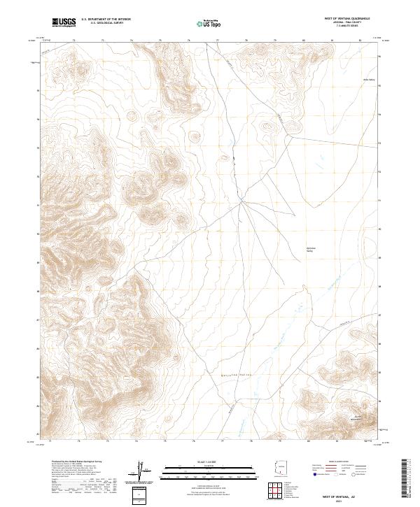
2021 Map of West of Ventana
USGS Topo · Published 2021About this map
Quijotoa Valley dominates the central and southern portions of this landscape, serving as a broad drainage basin for the ephemeral San Simon Wash. The terrain is defined by the sharp contrast between these level valley floors and the rising elevations of the Castle Mountains in the southeast corner. To the north, the Kaka Valley marks another distinct geographic depression. Transportation across this arid environment is limited to a sparse network of tribal routes and infrastructure corridors, including Indian Rte 23, Indian Rte 34, and the strictly linear Pipeline Rd in the far northwest. The map captures the quiet, undeveloped character of the Tohono O'odham Nation territory, where the natural hydrology of washes and the silhouettes of mountain ranges dictate the flow of travel and the placement of remote access roads.
Find a feature on this map
11 named features on this map. Tap any name to fly to it.
Don’t see what you’re looking for? This feature index may not catch every label — zoom into the map to look around manually.
Map Details
Editions of this 2021 West of Ventana Map
This is the sole edition of this map. No revisions or reprints were ever made.
Other maps of this area

1941 · Vekol Mountains
USGS Topo · 1:62,500

1942 · Vekol Mountains
USGS Topo · 1:62,500

1953 · Ajo
USGS Topo · 1:250,000

1957 · Ajo
USGS Topo · 1:250,000

1958 · Ajo
USGS Topo · 1:250,000

1958 · Kaka
USGS Topo · 1:62,500

1962 · Ajo
USGS Topo · 1:250,000

1963 · Ajo
USGS Topo · 1:250,000

1963 · Gu Achi
USGS Topo · 1:62,500

1963 · Cimarron Peak
USGS Topo · 1:62,500