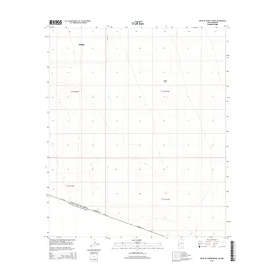
2014 Map of West of Vopoki Ridge
USGS Topo · Published 2014About this map
The Yuma Desert dominates this arid landscape south of Yuma, where the vast expanse of southwestern Arizona meets the international boundary. A sharp geometric divide is established by Border Rd, which runs along the line separating the United States of America and Estados Unidos Mexicanos. This 2014 survey illustrates the stark, undeveloped character of the desert floor, marked only by section lines and subtle elevation contours. The map captures the remote southern edge of Arizona, providing a precise look at the township and range divisions within Yuma Co just before the terrain transitions into Mexico. It is a portrait of a landscape defined more by political boundaries and surveying grids than by settlement or natural landmarks.
Find a feature on this map
10 named features on this map. Tap any name to fly to it.
Don’t see what you’re looking for? This feature index may not catch every label — zoom into the map to look around manually.
Map Details
Editions of this 2014 West of Vopoki Ridge Map
This is the sole edition of this map. No revisions or reprints were ever made.
Other maps of this area

1903 · Yuma
USGS Topo · 1:125,000

1905 · Yuma
USGS Topo · 1:125,000

1926 · Fortuna
USGS Topo · 1:62,500

1929 · Fortuna
USGS Topo · 1:62,500

1940 · Yuma
USGS Topo · 1:62,500

1942 · Yuma
USGS Topo · 1:250,000

1945 · Yuma
USGS Topo · 1:62,500

1954 · El Centro
USGS Topo · 1:250,000

1955 · El Centro
USGS Topo · 1:250,000

1958 · El Centro
USGS Topo · 1:250,000