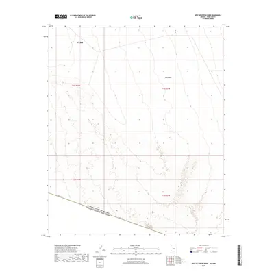
2018 Map of West of Vopoki Ridge
USGS Topo · Published 2018About this map
Yuma and the vast Yuma Desert dominate this southern Arizona survey, which tracks the international boundary where the United States and Mexico meet. The landscape is defined by its arid, open stretches and the critical transit corridor of Border Rd, which runs along the southern edge of the quadrangle. This 2018 edition reveals the modern surveying of the Sonoran landscape, where the shifting sands and gradual elevation changes are meticulously recorded through contour lines. The map provides a clear view of the geopolitical boundary and the isolated infrastructure necessary to maintain this remote borderland, offering researchers a precise look at the township and range divisions that structure this desert territory.
Find a feature on this map
8 named features on this map. Tap any name to fly to it.
Don’t see what you’re looking for? This feature index may not catch every label — zoom into the map to look around manually.
Map Details
Editions of this 2018 West of Vopoki Ridge Map
This is the sole edition of this map. No revisions or reprints were ever made.
Other maps of this area

1903 · Yuma
USGS Topo · 1:125,000

1905 · Yuma
USGS Topo · 1:125,000

1926 · Fortuna
USGS Topo · 1:62,500

1929 · Fortuna
USGS Topo · 1:62,500

1940 · Yuma
USGS Topo · 1:62,500

1942 · Yuma
USGS Topo · 1:250,000

1945 · Yuma
USGS Topo · 1:62,500

1954 · El Centro
USGS Topo · 1:250,000

1955 · El Centro
USGS Topo · 1:250,000

1958 · El Centro
USGS Topo · 1:250,000