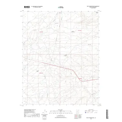
2018 Map of West of Window Rock
USGS Topo · Published 2018About this map
The Defiance Plateau dominates this high-altitude landscape west of Window Rock, where drainage systems carve deep into the sandstone terrain. Water movement defines the geography here, with Kinlichee Cr winding through the northern sections and Wide Ruin Wash traversing the broad Wide Ruin Valley to the south. The complex topography is punctuated by distinctive geological features such as Natural Bridge Canyon, Bear Canyon, and Aspen Canyon, reflecting a landscape shaped by seasonal erosion.
Find a feature on this map
21 named features on this map. Tap any name to fly to it.
Don’t see what you’re looking for? This feature index may not catch every label — zoom into the map to look around manually.
Map Details
Editions of this 2018 West of Window Rock Map
This is the sole edition of this map. No revisions or reprints were ever made.
Other maps of this area

1886 · Fort Defiance
USGS Topo · 1:250,000

1892 · Fort Defiance
USGS Topo · 1:250,000

1954 · Gallup
USGS Topo · 1:250,000

1955 · Zith-Tusayan Butte 2 SE
USGS Topo · 1:24,000

1955 · Zith-Tusayan Butte 4 NW
USGS Topo · 1:24,000

1955 · Zith-Tusayan Butte 3 NE
USGS Topo · 1:24,000

1955 · Zith-Tusayan Butte 4 NE
USGS Topo · 1:24,000

1955 · Zith-Tusayan Butte 1 SE
USGS Topo · 1:24,000
1955 · Zith-Tusayan Butte 1 SW
USGS Topo · 1:24,000
1955 · Nazlini
USGS Topo · 1:62,500