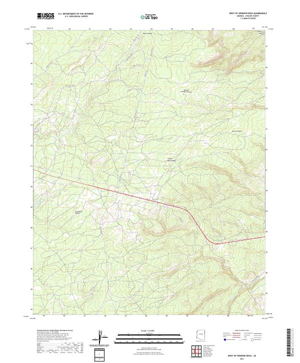
2021 Map of West of Window Rock
USGS Topo · Published 2021About this map
The high elevation of the Defiance Plateau and the broad Wide Ruin Valley define this portion of Apache County on the Navajo Nation. The landscape is deeply incised by drainages such as Kinlichee Cr and Wide Ruin Wash, which flow through topographically complex features like Natural Bridge Canyon and Juniper Bark Canyon. The road network is largely comprised of Bureau of Indian Affairs routes, including Indian Rte 2010 and Indian Rte 9800, which provide access across the plateau and valley floors. This modern survey reflects the enduring character of the high desert, where naming conventions like Aspen Canyon and Bear Canyon hint at the local ecology and wildlife found within these canyon systems. Geographic coordinates and township boundaries such as t27n r29e provide the structural framework for this remote landscape.
Find a feature on this map
21 named features on this map. Tap any name to fly to it.
Don’t see what you’re looking for? This feature index may not catch every label — zoom into the map to look around manually.
Map Details
Editions of this 2021 West of Window Rock Map
This is the sole edition of this map. No revisions or reprints were ever made.
Other maps of this area

1886 · Fort Defiance
USGS Topo · 1:250,000

1892 · Fort Defiance
USGS Topo · 1:250,000

1954 · Gallup
USGS Topo · 1:250,000

1955 · Zith-Tusayan Butte 2 SE
USGS Topo · 1:24,000

1955 · Zith-Tusayan Butte 4 NW
USGS Topo · 1:24,000

1955 · Zith-Tusayan Butte 3 NE
USGS Topo · 1:24,000

1955 · Zith-Tusayan Butte 4 NE
USGS Topo · 1:24,000

1955 · Zith-Tusayan Butte 1 SE
USGS Topo · 1:24,000
1955 · Zith-Tusayan Butte 1 SW
USGS Topo · 1:24,000
1955 · Nazlini
USGS Topo · 1:62,500