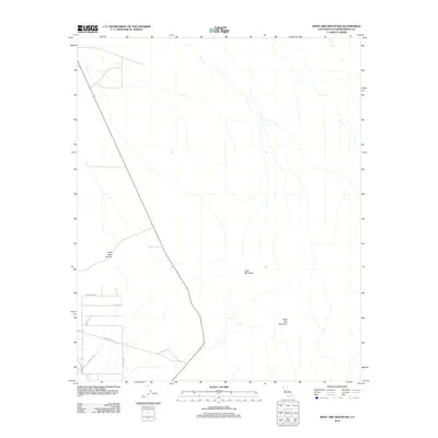
2012 Map of West Ord Mountain
USGS Topo · Published 2012About this map
West Ord Mountain and Goat Mountain dominate this high-desert landscape in San Bernardino County, where the terrain is marked by the deep cut of Traer Agua Canyon. This 2012 survey by the U.S. Geological Survey captures a sparsely populated transition area between mountain peaks and the desert floor. A remote water source, Taylor Spring, appears east of the main mountain mass, an essential feature for both historical livestock and modern desert life. The southwestern portion of the sheet reveals the early stages of desert residential development, with a grid of local roads including Villa Nova Rd, Millberry St, and the distinctively named Jay Jay Blvd. This map provides a precise record of how human habitation and infrastructure began to push into the arid slopes of the Ord Mountains during the early 21st century.
Find a feature on this map
11 named features on this map. Tap any name to fly to it.
Don’t see what you’re looking for? This feature index may not catch every label — zoom into the map to look around manually.
Map Details
Editions of this 2012 West Ord Mountain Map
This is the sole edition of this map. No revisions or reprints were ever made.
Other maps of this area

1932 · Barstow
USGS Topo · 1:125,000

1934 · Barstow
USGS Topo · 1:125,000

1953 · San Bernardino
USGS Topo · 1:250,000

1955 · Ord Mountains
USGS Topo · 1:62,500

1956 · San Bernardino
USGS Topo · 1:250,000

1956 · Daggett
USGS Topo · 1:62,500

1956 · Barstow
USGS Topo · 1:62,500

1957 · Apple Valley
USGS Topo · 1:62,500

1957 · San Bernardino
USGS Topo · 1:250,000

1958 · San Bernardino
USGS Topo · 1:250,000