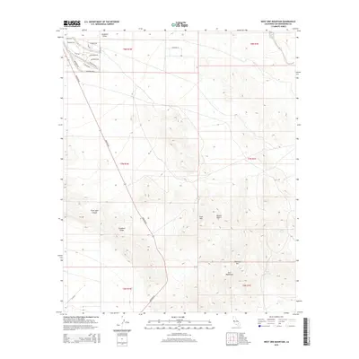
2015 Map of West Ord Mountain
USGS Topo · Published 2015About this map
Stoddard Valley defines the northern reaches of this high desert landscape, where the alluvial flats meet the rising granite of Stoddard Ridge. The terrain here is shaped by the complex topography of the Ord Mountains, a range characterized by isolated peaks and deep-cut drainage systems such as Traer Agua Canyon. Water remains a critical and scarce element in this corner of the Mojave Desert, marked by the locations of perennial sources like Goat Spring, Quill Spring, and Joker Spring. While the southern and central portions of the sheet remain largely undeveloped desert, the northwestern corner shows the encroachment of rural residential growth near Barstow Rd, featuring a grid of family-named streets such as Hazelnut Dr and Ponderosa Rd that contrast with the open wilderness of West Ord Mtn.
Find a feature on this map
31 named features on this map. Tap any name to fly to it.
Don’t see what you’re looking for? This feature index may not catch every label — zoom into the map to look around manually.
Map Details
Editions of this 2015 West Ord Mountain Map
This is the sole edition of this map. No revisions or reprints were ever made.
Other maps of this area

1932 · Barstow
USGS Topo · 1:125,000

1934 · Barstow
USGS Topo · 1:125,000

1953 · San Bernardino
USGS Topo · 1:250,000

1955 · Ord Mountains
USGS Topo · 1:62,500

1956 · San Bernardino
USGS Topo · 1:250,000

1956 · Daggett
USGS Topo · 1:62,500

1956 · Barstow
USGS Topo · 1:62,500

1957 · Apple Valley
USGS Topo · 1:62,500

1957 · San Bernardino
USGS Topo · 1:250,000

1958 · San Bernardino
USGS Topo · 1:250,000