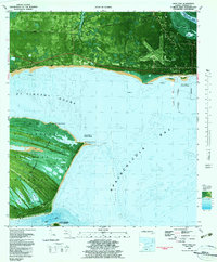
1982 Map of West Pass
USGS Topo · Published 1983About this map
St Vincent Island dominates this coastal landscape, serving as a significant natural anchor between the St Vincent Sound and the open gulf. This 1982 orthophotomap provides a rare hybrid view of the St Vincent National Wildlife Refuge, where the interior ridge and swale topography is punctuated by a series of numbered water bodies including Lake No 1, Lake No 2, and Lake No 3. On the mainland, the Apalachicola Municipal Airport and the Apa Army Test Facility reveal the strategic mid-century footprint in Franklin County, situated near the small settlements of Nine Mile and Tilton. The map also captures the critical maritime infrastructure of the Intracoastal Waterway as it transitions through the Apalachicola River, providing insight into the coastal navigation and defense heritage of the Florida Panhandle.
Find a feature on this map
41 named features on this map. Tap any name to fly to it.
Don’t see what you’re looking for? This feature index may not catch every label — zoom into the map to look around manually.
Map Details
Editions of this 1982 West Pass Map
2 editions found
Other maps of this area

1943 · West Pass
USGS Topo · 1:31,680

1943 · Apalachicola
USGS Topo · 1:31,680

1943 · Indian Pass
USGS Topo · 1:24,000

1943 · Jackson River
USGS Topo · 1:24,000

1944 · Apalachicola
USGS Topo · 1:24,000

1945 · Cape St. George
USGS Topo · 1:31,680

1945 · Lake Wimico
USGS Topo · 1:31,680

1945 · Beverly
USGS Topo · 1:31,680

1945 · Jackson River
USGS Topo · 1:31,680

1945 · Indian Pass
USGS Topo · 1:31,680