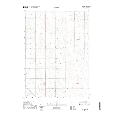
2017 Map of West Point NW
USGS Topo · Published 2017About this map
Cuming Cr and its various tributaries define the agricultural character of this Nebraska landscape in Cuming County. The land is organized by a strict grid of section roads, including 15th Rd through 21st Rd, reflecting the enduring legacy of the Public Land Survey System. In the southwest corner, the Elkhorn River flows near the confluence with Plum Creek, marking a shift in the terrain toward the river valley. A significant point of interest for local historians and genealogists is Dewitt Cem, located just west of Felix Cr. The map illustrates how drainage systems like Little Logan Cr and Willow Cr influence the placement of rural homesteads and farmsteads within the townships of t23n r6e, t23n r7e, and their southern counterparts.
Find a feature on this map
27 named features on this map. Tap any name to fly to it.
Don’t see what you’re looking for? This feature index may not catch every label — zoom into the map to look around manually.
Map Details
Editions of this 2017 West Point NW Map
This is the sole edition of this map. No revisions or reprints were ever made.
Other maps of this area

1955 · Sioux City
USGS Topo · 1:250,000

1955 · Fremont
USGS Topo · 1:250,000

1957 · Fremont
USGS Topo · 1:250,000

1958 · Sioux City
USGS Topo · 1:250,000

1958 · Fremont
USGS Topo · 1:250,000

1959 · Sioux City
USGS Topo · 1:250,000

1966 · West Point NW
USGS Topo · 1:24,000

1966 · West Point SE
USGS Topo · 1:24,000

1966 · Monterey
USGS Topo · 1:24,000
1966 · Beemer
USGS Topo · 1:24,000