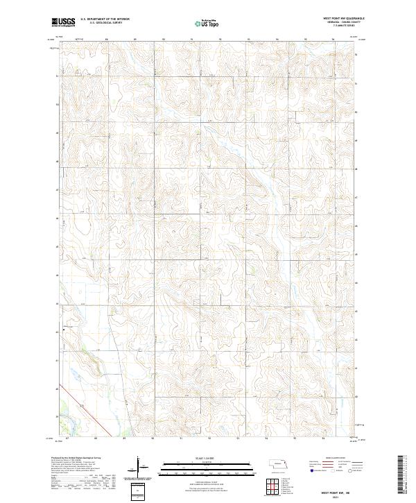
2021 Map of West Point NW
USGS Topo · Published 2021About this map
Dewitt Cem stands as a focal point for genealogical research in this rural portion of Cuming County, located just north of the Elkhorn River valley. The landscape is defined by a dense network of watercourses, including Cuming Cr and Felix Cr, which carve through the agricultural terrain. The section-line road system, including routes like 15th Rd and M Rd, reflects the enduring Public Land Survey System structure that has governed Nebraska's farmsteads for generations. Toward the southern edge of the map, Plum Creek and Willow Cr converge near the river, illustrating the drainage patterns that shaped early settlement and land use in this fertile region.
Find a feature on this map
27 named features on this map. Tap any name to fly to it.
Don’t see what you’re looking for? This feature index may not catch every label — zoom into the map to look around manually.
Map Details
Editions of this 2021 West Point NW Map
This is the sole edition of this map. No revisions or reprints were ever made.
Other maps of this area

1955 · Sioux City
USGS Topo · 1:250,000

1955 · Fremont
USGS Topo · 1:250,000

1957 · Fremont
USGS Topo · 1:250,000

1958 · Sioux City
USGS Topo · 1:250,000

1958 · Fremont
USGS Topo · 1:250,000

1959 · Sioux City
USGS Topo · 1:250,000

1966 · West Point NW
USGS Topo · 1:24,000

1966 · West Point SE
USGS Topo · 1:24,000

1966 · Monterey
USGS Topo · 1:24,000
1966 · Beemer
USGS Topo · 1:24,000